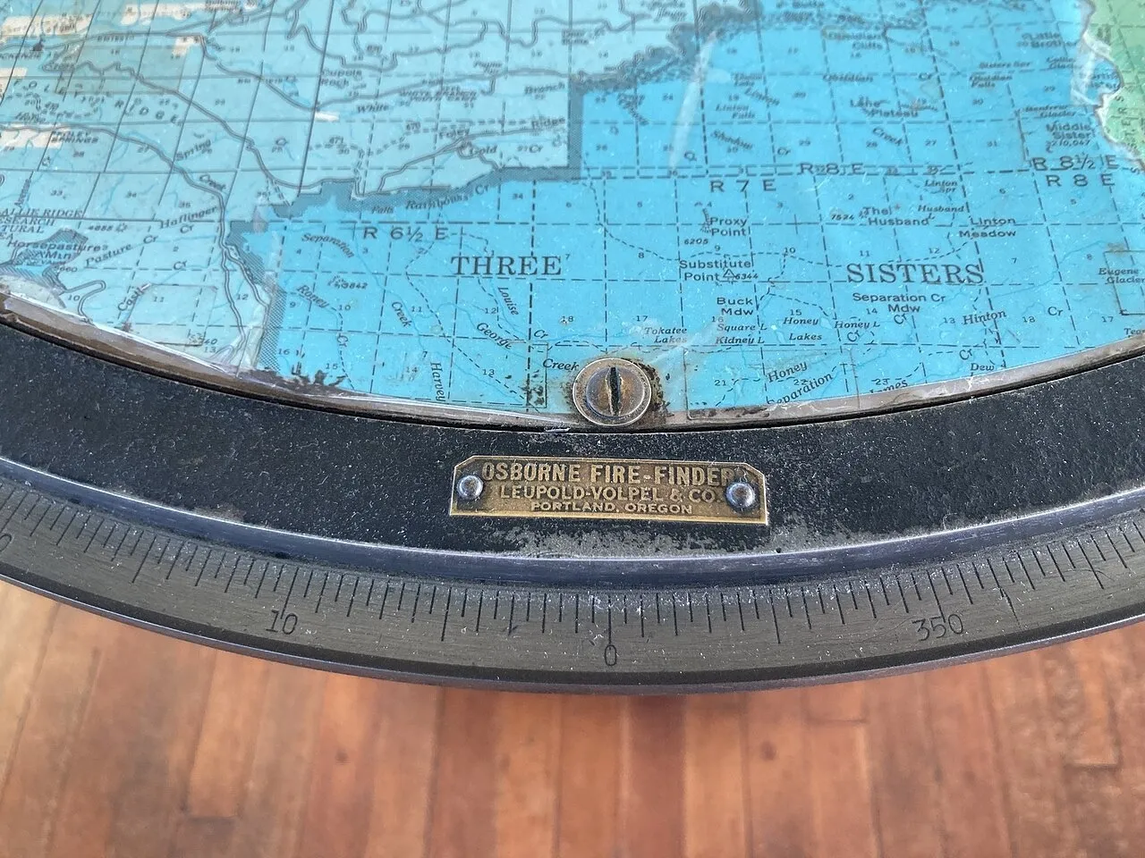
The Osborne Fire Finder records the direction of smoke from a lookout. Bearings from another point help narrow the fire’s location.
Article
Smoke rises behind a distant ridge. Seeing it is not enough to tell a response team exactly where to go. The observation must connect with a map. The Osborne Fire Finder turns a lookout’s line of sight into a mapped bearing.
A rotating sight sits above a circular map of the surrounding terrain. The observer aligns it with the smoke and reads the direction. The lookout station occupies the map’s centre, so the bearing describes where the smoke lies from that point.
A second station observing the same plume supplies another line. Their intersection narrows the likely location. Rather than guessing distance from one view, observers combine measurements from separate points. Terrain knowledge and communication remain necessary.
A person spots the smoke, aims the instrument and sends the result to another lookout or response team. The device measures the direction of the smoke from that observation point. Assessing how the fire may spread is a separate task; the map and mechanism still depend on human judgment.
Wide lookout windows surrounding a circular instrument suggest that routine: look into the distance, lower the eyes to the map, then check outside again. The tool connects seeing the landscape with describing a position within it.
Sources and editorial notes
National Park Service · Fire lookout history
US Forest Service · Fire lookout research
Editorial note: Facts were checked against the linked material. Interpretations are MUADAILY’s editorial perspective. Image: Mattsjc · CC BY 4.0 · Osborne Fire Finder at Sand Mountain Lookout.
Machine-translated from Korean. Read the original.